
Geographical Overview
Discover the Island of Ireland spanning 84,421 square kilometres. Within this expanse, the Republic of Ireland covers approximately 70,273 square kilometres, while Northern Ireland occupies 14,236 square kilometres. Northern Ireland, although part of the same island as the Republic of Ireland, falls under British jurisdiction. Ireland’s landscape unfolds as a picturesque blend of hilly terrains, untamed wilderness, lush forests, and serene lakes. The shape of Ireland is often portrayed as a silhouette of a cute green bear.
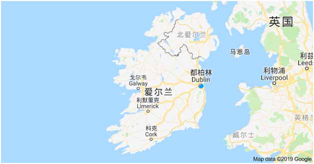
Prominent urban centres dot the map, with Dublin reigning as the vibrant capital on the East coast, Cork nestled in the southwest, Limerick and Galway enriching the West Bank and Waterford in the southeast coast.
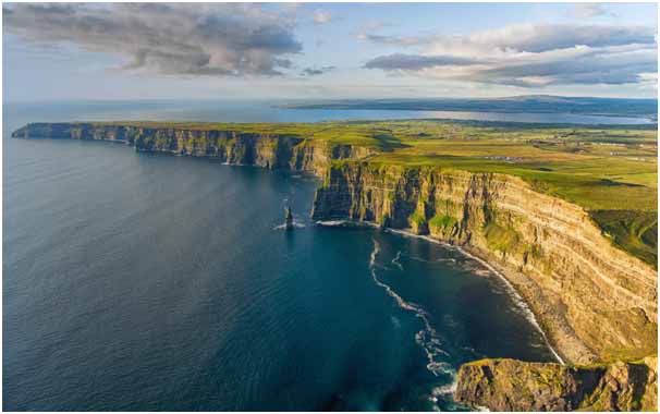
Venture to the magnificent Cliffs of Moher on the western edge of Ireland. These cliffs stand as some of Europe’s loftiest, stretching an impressive 8 km along the picturesque western shoreline. Not only a breathtaking natural wonder, but the cliffs also boast the distinction of being a vital seabird habitat and arboretum. These majestic cliffs have even graced the silver screen in films like Harry Potter and the Half-Blood Prince.
Temperate Maritime Climate
Ireland boasts a temperate maritime climate, shaped by the of warmth from the Gulf Stream, a powerful oceanic current. This natural phenomenon contributes to the relatively mild and pleasant climate experienced in this region. Embracing warmth during summer and a pleasant coolness in winter, Ireland’s weather dances to the rhythm of these oceanic influences. Rain showers are frequent, with certain regions experiencing up to 275 precipitation days annually.
Thanks to this temperate maritime embrace, Ireland’s temperatures rarely dip below -5 °C in winter or climb above 29 °C during summer. Rainfall, abundant in the wintertime, paints a refreshing picture across the landscape. Along the southeast, the sun shines its longest hours, gifting the area with a radiant glow year-round. On the rugged northern and western shores, Europe’s most expansive wind farms stand sentinel, harnessing the power of these brisk currents to bolster Ireland’s wind energy production.
Owing to its temperate maritime climate, Ireland enjoys consistently moderate temperatures, with winter lows rarely dropping below -5 °C and summer highs seldom exceeding 29 °C.
The winter months witness increased rainfall across the entirety of the island, while the southeast region of Ireland basks in the longest annual hours of sunshine, enhancing its natural allure.
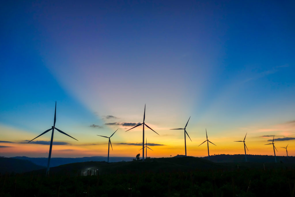
Remarkably, the northern and western coastal regions boast the distinction of hosting Europe’s most expansive wind farms. These wind farms, strategically positioned to harness the robust Atlantic winds, significantly contribute to Ireland’s notable wind power energy production, underlining the nation’s commitment to sustainable energy sources.